River Avon Navigation
What is it?
The
River Avon (one of a number of rivers carrying this name in England)
flows from
Bath through Bristol then, via the Avon Gorge, into the Bristol
Channel. Bristol had been a major port since Saxon times, but
obstruction of the river by weirs, used to provide a suitable head of
water for the adjacent mills, made progress further upstream difficult.
Ralph Allen was one of those instrumental in the improvements which
made the River Avon navigable as high up as Bath. Work started in 1727,
in the same year that Allen bought the old Roman stone mines in Combe
Down. Allen employed the Bristol engineer John Padmore to construct a
wooden railway to transport his stone down the hillside from the mines
to a wharf on the Avon. The trucks carrying the stone had flanged metal
wheels to keep them on the track and descended under gravity, speed
being controlled by a mechanical brake. The stone was loaded onto
barges and taken to Bristol and beyond. [
Forsyth
2003]
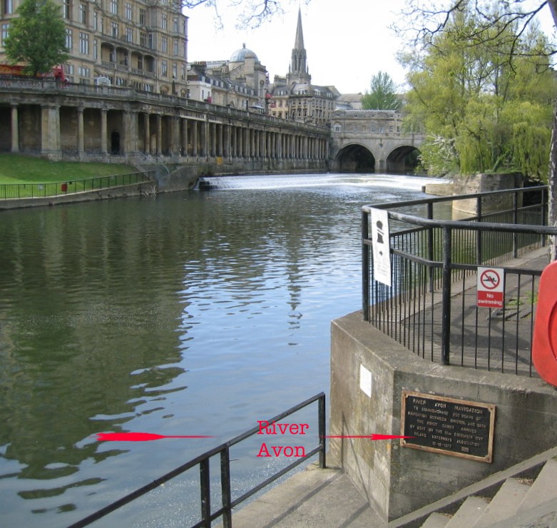
Where is it in Bath?
The plaque is on the east bank of the River Avon just downstream from
Pulteney Bridge:
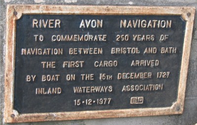
The text reads:
"River Avon Navigation
To commemorate 250 years of navigation between Bristol and Bath
The first cargo arrived by boat on 15th December 1727
Inland Waterways Association 15.12.1977"
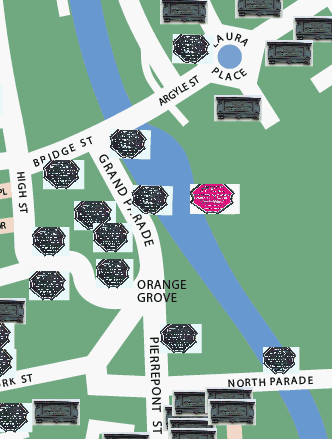
Location map of River Avon navigation plaque:
(c) 2011
Bath-Heritage.co.uk | Contact us|