William Smith Column of Stones
Who was he?
Wikipedia:
William Smith was an English geologist, credited with creating the
first nationwide geological map.
Why was he in Bath?
William Smith visited his supporters at no. 29, Great Pulteney
Street (see separate page
here).
He worked on the Somerset coalfield and the Somerset Coal Canal.
He lived near the canal at Tucking Mill from 1798 to 1810 (see
separate page
here).
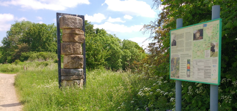
There is a column of stones commemorating William Smith's work
alongside the cycle/walking path that follows the track bed of the
disused Somerset and Dorset Joint Railway. Next to the column is
an information board.
Column of Stones alongside Railway Path:
 The information board on the
right gives information about the work of William Smith and the
structure of the column:
The information board on the
right gives information about the work of William Smith and the
structure of the column:
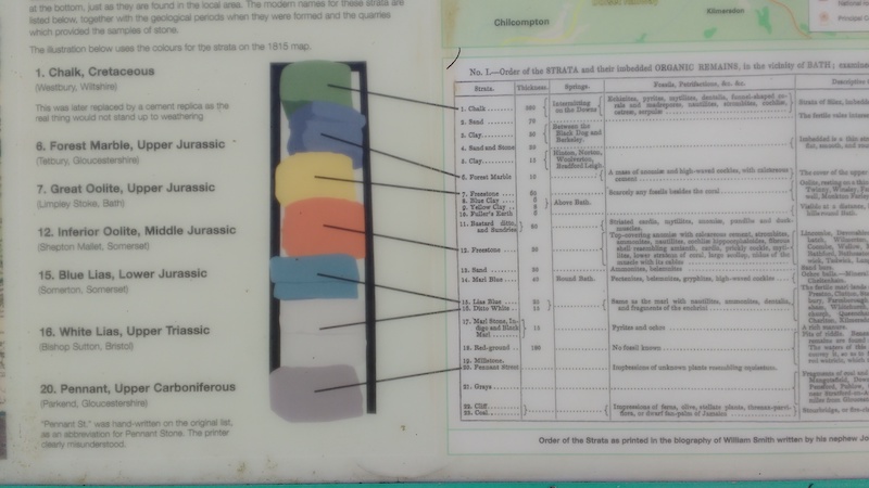
The text on the left gives the order of the stones in the
column
1. Chalk, Cretaceous
(Westbury, Wiltshire)
This was later replaced by a cement replica as the real thing
would not stand up to weathering
6. Forest Marble, Upper Jurassic
(Tetbury, Gloucestershire)
7. Great Oolite, Upper Jurassic
(Limpley Stoke, Bath)
12. Inferior Oolite, Middle Jurassic
(Shepton Mallet, Somerset)
15. Blue Lias, Lower Jurassic
(Somerton, Somerset)
16. White Lias, Upper Triassic
(Bishop Sutton, Bristol)
20. Pennant, Upper Carboniferous
(Parkend, Gloucestershire)
(Numbering as on the original list of the “Order of the STRATA” on
the right of the image above)
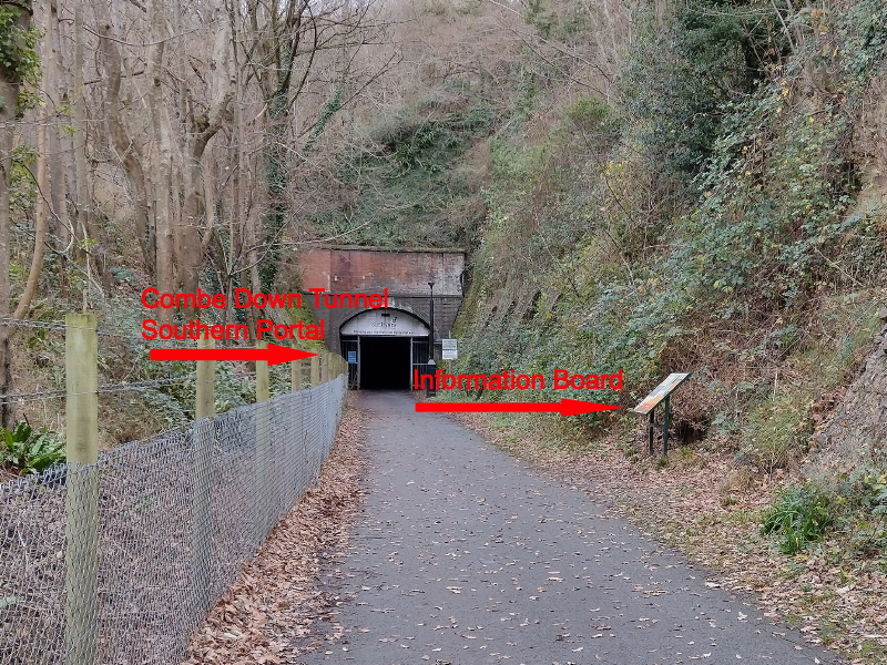
The path connects Bath to the village of Wellow. In doing so, it
passes through two tunnels, hence the path is named "Two Tunnels".
The longer tunnel under Combe Down, opened in 1874, is 1,829-yard
(1,672 m) long and was once the UK’s longest without intermediate
ventilation
https://en.wikipedia.org/wiki/Combe_Down_Tunnel.
Just outside the southern portal is an information board giving
more details of William Smith's work:
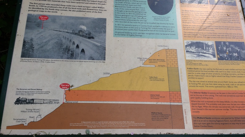
The image (below) shows a steam locomotive heading a train
emerging from the tunnel:
Location map of Combe Down Tunnel on Two Tunnels Railway Path:
(c) 2021
Bath-Heritage.co.uk | Contact us|