Avon Flood Prevention
What is it?
The riverside areas of Bath regularly suffered from flooding of the
River Avon up to the middle of the twentieth century. Flood levels are
marked on the buttress of
Widcombe
footbridge, on buildings in
Grove
Street and on
Norfolk
Buildings.
Frank Greenhalgh
was appointed Engineer to the River Avon (Bristol) Catchment Board in
1953 and he started to tackle the problem systematically. Another
disastrous flood in 1960
increased the urgency and over the ten year
period 1963-1972 the river was dredged, banks were raised and
reinforced by sheet-piling.
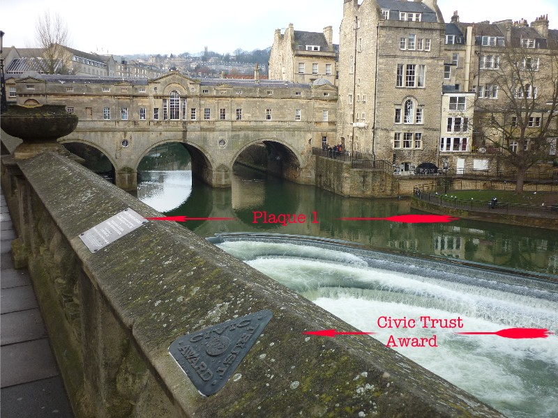
Pulteney Weir
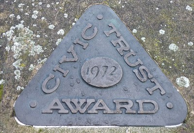
was redesigned and new sluice gates were installed. The work received a
Civic Trust Award in 1972 and a commemorative plaque is set into the
parapet of Grand Parade overlooking the weir [
Buchanan
2008].
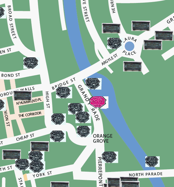
Where is it in Bath?
The weir is on the River Avon just downstream from
Pulteney Bridge:
 (For information
on Plaque 1, refer to the Pulteney Weir
page.)
(For information
on Plaque 1, refer to the Pulteney Weir
page.)
Location map of Civic Trust Award plaque:
(c) 2012
Bath-Heritage.co.uk | Contact us|